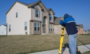
Land surveying, in short, is the science and art of establishing or re-establishing property corners, property lines and/or boundaries. There are different reasons why someone wants a lot surveyed.
Essentially the most common is to check if a piece of land is vulnerable to flooding, to subdivide a property to sell or to determine if there are any encroachments. This may happen if a neighbor disputes that you are using a piece of his lot or vice versa (for more on this, go here).
The Cost of Land Surveying
If you need to have a piece of land surveyed, the first thing that will come to mind is “how much will it cost?”There are plenty of factors determining exactly how much land surveying for your land would cost.
The fact that this type of service must be carried out by an expert contributes a great deal to the overall cost of the service, but choosing a non-professional to survey your land is dangerous and possibly illegal for the non-professional. Because of this you have to take a good look around before settling with a surveying company.
If you must work within a particular budget, discuss this with the surveyor up-front. Very often he may be able to offer cost saving steps to get the work you need done within these cost limits. The form of the land must also be looked into. A square or even a rectangle piece of land is somewhat easier to survey than an odd shaped parcel, or one with many different sides.
With the latter, the surveyor would have to take more time in surveying the curves as well as the bends which means the cost of the service would go higher.
The overall measurements the land is also key factor here. Understand that the cost of land surveying is normally proportionate to the time and effort that the land surveyor would spend on the project. If the land that you’re having surveyed isn’t accessible, or has thick vegetation, then the total price of the survey might go higher.
This is true of the varying weather conditions that might impact the work. Surveying in warm weather is somewhat slower to keep from putting the crew members in danger. Also, most surveying can’t be done in the rain.
When requesting for an estimate, bear in mind that surveyors base the estimate on expected conditions at the site. These conditions could change, bringing about additional costs. Always ask about these potential additional cost scenarios.
All that being said, competitive prices are also to be expected, this is why we recommend deciding on a surveyor based upon his experience and reputation rather than on the price he writes on a piece of paper. Usually it is better to invest a good amount of money on a survey that’s well-done rather than choose a company with a very “affordable” price but have the survey repeated because the results were wrong.
To sum it up, you should always discuss the expenses of the survey before you decide to ask the surveyor to start his work. It’s also wise to receive a contract that lets you know what is expected of the land surveyor. This is one of the most important steps in getting your land surveyed.


