If you live in Miami, you probably love your backyard—the palm trees, the sunshine, maybe even a pool. But do you really know where your property ends and your neighbor’s begins? A boundary survey can clear that up. In fact, sometimes a boundary survey will even redraw your backyard limits, and that can change everything about how you use your space.
So, what exactly is a boundary survey? Why might it change your property lines? And what should you do if that happens? Let’s break it down, especially for homeowners, where coastal lines and city rules can make things tricky.
What Is a Boundary Survey?
A boundary survey is a professional service that measures your land and marks the exact edges of your property. A licensed surveyor uses maps, legal documents, and special tools to find the true property lines. This is important because property lines don’t always match what you see on a fence or where you think your yard ends.
In Miami, where some homes sit near water or flood zones, these surveys become even more important. The land can shift over time, and local regulations might affect where your boundaries lie. That’s why many homeowners get boundary surveys before buying, selling, or building.
Why Can a Boundary Survey Redraw Your Backyard Limits?
You might think your property lines are set in stone, but a boundary survey can sometimes change what you expect. Here’s why:
- Old or Incorrect Records: Sometimes the official property maps are old or inaccurate. When a surveyor checks carefully, they might find errors in previous surveys or legal documents.
- Encroachments: Over the years, neighbors might have accidentally built fences, decks, or sheds that cross property lines. A new survey can reveal these overlaps.
- Legal Changes: Easements (which give others rights to use part of your land), right-of-ways, or city planning rules might adjust your boundaries.
- Natural Changes: In Miami, storms, flooding, or erosion can shift the land, especially near the coast. This can affect your property lines.
Because of these reasons, a boundary survey might redraw your backyard limits—meaning your usable land could be bigger or smaller than you thought.
What Happens During a Boundary Survey?

When you hire a surveyor, they do more than just walk around your yard. The process includes:
- Research: They look at old property deeds, maps, and any previous surveys to gather all the background information.
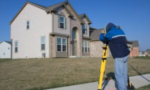
- Fieldwork: Using GPS and measurement tools, the surveyor measures your land carefully and looks for markers like stakes or iron pins that mark boundaries.
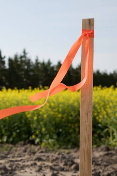
- Marking Boundaries: The surveyor places new markers to clearly show where your property lines are now.
- Mapping: They create a detailed map, called a plat, showing the exact boundaries based on their findings.
This detailed process explains why your property lines might change after a survey.
Why Do Homeowners Need a Boundary Survey?
Knowing exactly where your property begins and ends can save a lot of headaches. That’s why many homeowners invest in a Boundary Survey. This service helps protect your land, your plans, and your peace of mind.
- Planning a Build or Renovation: Whether you’re adding a pool, building a shed, or putting up a fence, a survey clarifies your property limits. You’ll avoid accidentally crossing onto a neighbor’s land or violating local regulations.
- Buying or Selling a Home: A clear survey gives buyers and sellers confidence. It shows the precise boundaries, so everyone knows what’s included and surprises are avoided.
- Preventing Neighbor Disputes: In neighborhoods where yards are close together, misunderstandings about fences, trees, or driveways are common. A survey helps settle these questions before they become problems.
- Managing Flood Risks: For properties in flood-prone areas, understanding your land’s exact limits is important for insurance, safety, and compliance purposes.
By confirming your property lines early, you can plan projects, protect your investment, and maintain good relations with neighbors — all without stress or guesswork.
What If Your Boundary Survey Redraws Your Backyard Limits?
Finding out your property lines have changed might feel unsettling, but it’s not the end of the world. The first step is to review the survey report carefully and understand exactly how your property limits have shifted. After that, it’s wise to talk to your neighbors, especially if the survey reveals any overlaps or encroachments.
Friendly communication can often prevent bigger problems down the line. If the situation seems complicated or if disagreements arise, consulting a property lawyer who knows Florida law can be a smart move. Don’t forget to update your property records to reflect the new boundaries—this will save you trouble later when selling or refinancing. Lastly, make sure to plan any future building or landscaping according to the updated boundaries to stay within your legal limits.
How a Boundary Survey Can Save You Money
At first, paying $300 to $800 for a boundary survey might seem like a lot. However, consider what it can save you:
- Avoid Legal Fights: Boundary disputes can lead to costly lawsuits that drag on for months or years.
- Prevent Costly Mistakes: Building a fence or structure in the wrong place might mean demolition and rebuilding.
- Protect Your Investment: Knowing your exact property limits gives peace of mind and protects your home’s value.
Choosing the Right Surveyor
Choosing the right surveyor makes all the difference. Look for someone who is licensed and certified and has experience with residential properties. It’s a bonus if they understand unique zoning rules, flood regulations, and soil conditions.To feel confident, check reviews or ask for references so you know you’re hiring someone reliable and knowledgeable.
Final Thoughts
Living means enjoying beautiful weather and unique properties, but it also means dealing with challenges like flood zones and close neighbors. A boundary survey helps you know exactly where your land begins and ends. Even if that means your backyard limits get redrawn, it protects you from costly disputes and surprises.
Whether you plan to build, sell, or just want peace of mind, getting a boundary survey is a smart move for every homeowner. It clears confusion, strengthens your property rights, and gives you confidence in your land.


