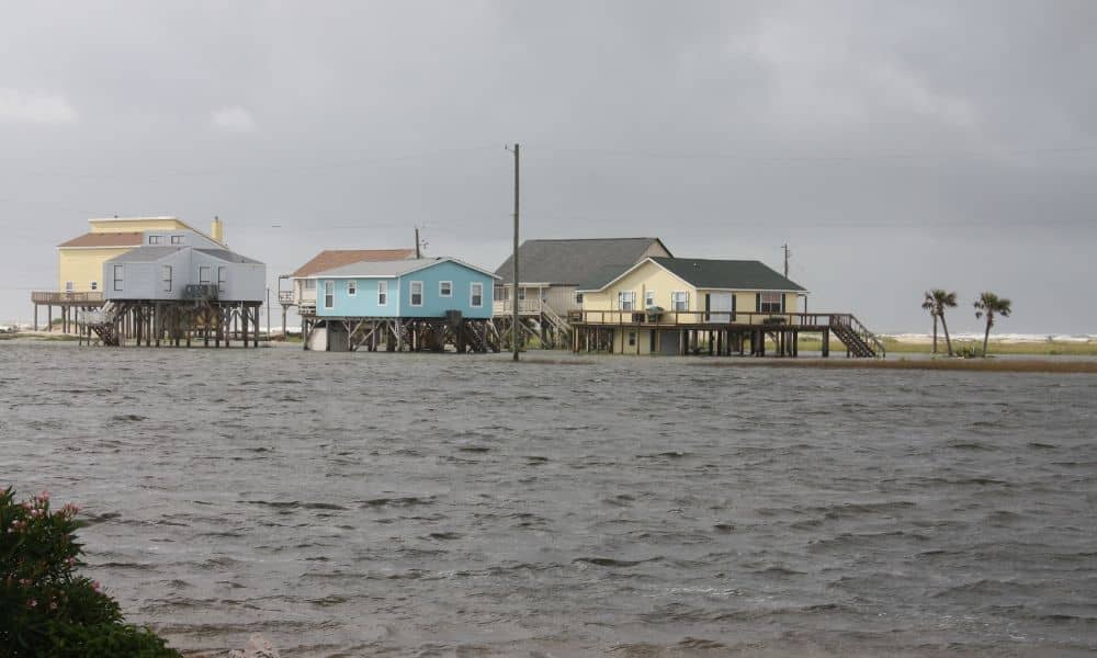
Miami is famous for its sunshine and waterfront lifestyle—but lately, even sunny days have been bringing floods. Streets in Brickell, Edgewater, and Miami Beach are turning into shallow rivers during high tide. These “sunny-day floods” are a reminder that the city’s relationship with rising seas is changing fast. And with that change comes something most homeowners never expected: elevation certificate chaos.
In the last few weeks, surveyors, insurance agents, and homeowners have been rushing to review or update their elevation certificates after king tides sent water lapping at driveways. It’s not just about getting your feet wet—it’s about keeping your insurance valid, your premiums fair, and your paperwork accurate.
When Dry Weather Turns to Deep Trouble
Every fall, Miami experiences what’s known as king tides. These are the highest tides of the year, caused by the alignment of the sun and moon. Normally, they’re a quirky local event—good for photos and social media posts. But now, with rising sea levels, king tides are flooding streets even without a drop of rain.
This October, several neighborhoods found themselves underwater again. Cars stalled on Alton Road. Sidewalks vanished beneath briny puddles. And as homeowners watched the ocean inch closer to their doors, a familiar question returned: Is my property still high enough to stay insured?
That question is where elevation certificates come in.
Why Everyone’s Suddenly Talking About Elevation Certificates

An elevation certificate, or EC, is a document prepared by a licensed surveyor. It measures how high your property sits compared to the local flood level. Insurers, builders, and lenders use it to understand flood risk and set fair insurance rates.
When the ocean rises, even by a few inches, your property’s flood zone can change. That means an EC from three or four years ago might no longer reflect the truth. And during this month’s flooding, hundreds of homeowners discovered that their old certificates were out of date—or worse, based on the wrong reference system.
Without an accurate EC, insurance companies can’t verify your home’s elevation. That can delay renewals, increase premiums, or even hold up mortgage approvals. It’s not just paperwork—it’s peace of mind.
The Hidden Culprit: Datum Confusion
Here’s where things get tricky. Every elevation certificate relies on something called a vertical datum—a baseline used to measure height. The problem? Miami has two main datums: NGVD29 and NAVD88. They don’t match.
NAVD88 is the modern standard, while NGVD29 is an older system still found on older certificates. The difference between the two in Miami Beach is about +1.56 feet. That means a house listed at 10 feet in NGVD29 might only be 8.44 feet in NAVD88 terms—a big deal when flood insurance is on the line.
During the recent king tides, that small difference caused major confusion. Some homeowners thought their homes were safely above base flood elevation, only to find out they weren’t. Surveyors across Miami-Dade started getting urgent calls asking for “datum conversions” and rechecks.
In short, a single number—+1.56—became the reason many insurance renewals stalled.
Why the Flooding Created a Paperwork Wave
When streets flood on clear days, people start checking their flood policies. That’s exactly what happened this month. Homeowners rushed to verify their coverage, while banks and insurance providers requested updated elevation certificates to reflect current flood risks.
But Miami’s surveying community can only move so fast. Dozens of local firms are now juggling backlogged requests, and FEMA’s online map services have been temporarily overloaded. What began as a local weather story has become a bureaucratic storm.
Even small details—like whether a certificate includes photos or specifies the correct benchmark—are now under scrutiny. Insurance adjusters are rejecting old or incomplete forms, forcing property owners to pay for new surveys. For many, this was an unexpected expense—but a necessary one to stay protected.
How Homeowners Are Coping
For homeowners, the flood water dries up quickly, but the paperwork doesn’t. Many are calling surveyors to check whether their certificates are still accurate. Others are discovering they never had one in the first place.
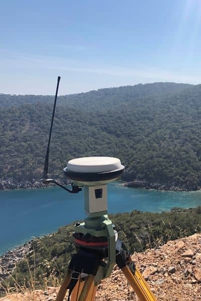
Getting an updated EC isn’t complicated, but it takes planning. A licensed surveyor measures your home’s lowest floor, ground elevation, and nearby benchmarks, then compares them to FEMA’s flood data. The process usually takes three to five business days, longer if demand spikes—as it did after the latest king tides.
Costs vary depending on property type and size, but most residential updates range from $400 to $700. That’s a small price to pay compared to what an inaccurate EC could cost you in insurance premiums or denied claims.
How to Stay Ahead of the Tide
If you’re in a flood-prone area, don’t wait for the next storm or king tide to act. Start by checking the date and datum on your current elevation certificate. If it lists NGVD29, it’s time to switch to NAVD88. You can also ask your surveyor to confirm the benchmark used and ensure your form includes all required photos—details insurers now check closely.
It also helps to understand that ECs don’t technically expire, but they do become invalid if the structure changes or if new flood maps are released. In fast-changing coastal zones like Miami, those updates are happening more often than ever.
The goal isn’t just to have a certificate on file—it’s to have one that reflects today’s flood reality, not last decade’s.
From Chaos to Clarity
The current wave of sunny-day flooding has been a wake-up call. It’s shown how small details—like a forgotten form or an outdated datum—can have real financial consequences. But it’s also a reminder that preparation still pays off.
Homeowners who maintain updated elevation certificates are better positioned to manage rising premiums, secure loans, and rebuild after storms. They’re not just reacting to the water—they’re staying ahead of it.
King tides may keep coming, and flood maps may keep shifting, but accurate data gives homeowners control. In a city built on the edge of the ocean, knowing your true elevation isn’t just about compliance—it’s about confidence.
Final Word
The next time you see a sunny-day flood filling the streets of Miami, remember it’s more than a seasonal inconvenience. It’s a signal that the numbers on your elevation certificate might need a second look.
Updating it now means fewer surprises later—no rejected insurance claims, no last-minute rush before hurricane season, and no confusion over datums or conversions. In a city where the tides are rising and the rules keep changing, a clear, accurate certificate is one piece of paperwork that can save you thousands—and a lot of stress.


