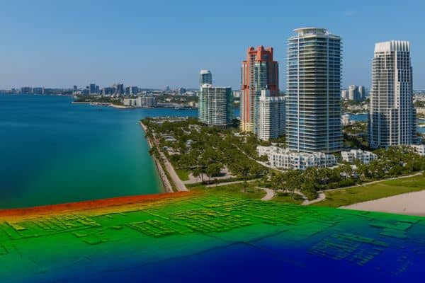
Miami is one of the fastest-growing cities in the U.S. With new condos, homes, and mixed-use buildings popping up everywhere, developers and real estate professionals need tools that help them move quickly—but also make smart decisions. One tool that’s becoming more and more popular is LiDAR mapping.
If you’re working on real estate projects in or around Miami, here are five major reasons why LiDAR could be your new best friend.
1. Accurate Site Analysis from the Start
Before you build anything, you need to understand the land you’re working with. Is the lot sloped? Are there dips or high spots that could cause drainage problems? LiDAR scans give you a super-detailed 3D map of the area, showing every bump and curve in the ground.
This helps you plan smarter from the very beginning. You’ll know where to build, what to avoid, and how much work the land might need—before you even break ground.
2. Faster Approvals and Easier Permits
In a city like Miami, where zoning and environmental rules can be strict, having the right data can speed things up. LiDAR data can help support your permit applications, environmental assessments, and engineering reports.
With solid elevation and terrain data in hand, city officials and agencies are more likely to approve your project faster—saving you time and stress.
3. Lower Risk and Fewer Costly Surprises
Every real estate project comes with risk. Maybe the ground isn’t as flat as you thought, or a nearby wetland shifts your building plans. LiDAR helps spot those issues early, so you’re not making last-minute changes that eat into your budget.
It’s a simple rule: the better the data, the fewer the surprises. And fewer surprises mean a smoother project.
4. Better Design and Planning
LiDAR data isn’t just for surveyors—it helps architects and engineers too. The 3D maps it produces can be added to planning software, helping design teams see how buildings will fit into the land. From grading and drainage to building height and layout, LiDAR makes everything more precise.
That means better results—and fewer do-overs.
5. Helps You Manage Flood Risk
Miami is a coastal city. With sea levels rising and hurricanes becoming more intense, flood risk is a serious concern. LiDAR mapping helps show exactly where water might collect or flow during storms.
This is key for staying in line with FEMA rules, getting flood insurance, and keeping your future buildings—and buyers—safe. If you’re submitting paperwork for a LOMA or LOMR, LiDAR data can make the process much easier.
Real Results for Miami Real Estate

Whether you’re planning a luxury condo near Biscayne Bay or a new community inland, accurate site data is essential. LiDAR mapping in Miami, FL is becoming the go-to choice for real estate developers who want to save time, reduce risk, and make smart, informed decisions.
Final Thoughts
Real estate in Miami moves fast—but that doesn’t mean you should skip the details. LiDAR mapping offers a clear view of the land, helping you build smarter, safer, and more efficiently.
If you’re starting a new project, talk to a local LiDAR expert before breaking ground. It might just be the smartest move you make.